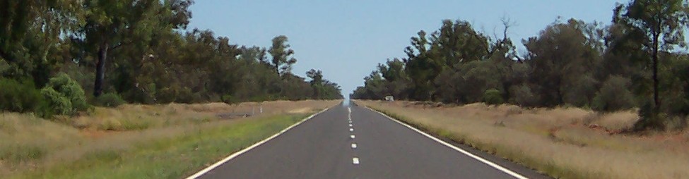
Trip 6: Stranraer

Saturday 6 July 2013


View Trip 6: Stranraer in a larger map

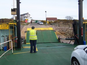
For this trip I decided to go all the way down the west coast to Stranraer. I’d been as far as Girvan before, but never all the way.

There are three routes you can take from Glasgow, 1) all the way round the coast via Gourock, 2) inland down the A737 to Irvine, or 3) go the whole way on the A77. The forecast was for fine weather so it had to be the coast road. It had been a few years since I’d last been that way and there had been some changes. All the old ship yards between Port Glasgow and Greenock were gone – a few cranes were left – but now a vast superstore had replaced what used to be Scott Lithgows (I think) and many of the old warehouses had been converted into trendy flats.

It was hazy for most of the way along the Clyde estuary.
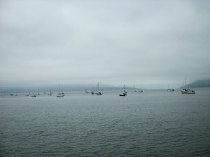
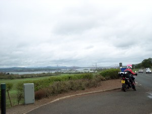
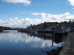
View from Gourock

View from Gourock

Rounding the bend at Gourock things began to clear and by Irvine things were brightening up considerably. At Ayr, I missed the turning for the A77 and somehow managed to get myself onto a back road and ended up taking a rather convuluted route to Turnberry where the two roads joined.
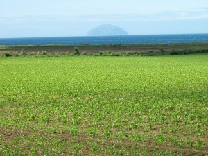
Ailsa Craig from A77

Ailsa Craig from A77

A quick stop in Girvan for lunch and to admire the only sandy beach I’d see all day.
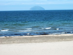
Ailsa Craig from Girvan Beach

Ailsa Craig from Girvan Beach

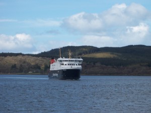
From here it was a clear run all the way to Stranraer. At Cairnryan I noticed there was a nice new terminal for Stena Lines’ crossings to Belfast. Funny, I thought they went from Stranraer.
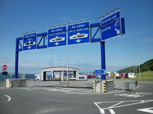
New Stena Lines ferry terminal at Cairnryan

New Stena Lines ferry terminal at Cairnryan

A mile or so on was the P & O terminal to Larne. Strange, could have sworn the ferries went from Stranraer.

In Stranraer the mystery was solved, the Stena Line terminal had been closed down and moved to Cairnryan.
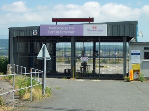
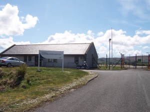
The old ferry terminal at Stranraer

The old ferry terminal at Stranraer

By this time I was bursting for the loo, so I enquired at the Police Station where I might find a public convenience. “The Library” I was informed. I set off in search of this only to discover it was closed. The Tourist Information Office was over the road so I asked if there was another one. “Take a right at the ??? Hotel, then right again, right again, and Morrison’s have one there”. Great, but what was the name of that hotel again? Passing one that seemed like it might be the right one, I turned right. Obviously not, and before I knew it I was on the road out of town to Dumfries. “All right”, I thought, “let’s try Newton Stewart instead.”

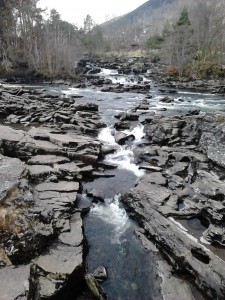
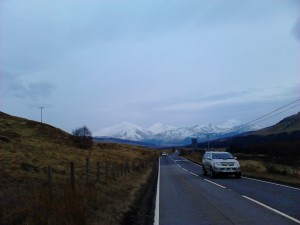
The Gulf petrol station in Newton Stewart had a very nice toilet, so all was well. From here I took the A712 to New Galloway – a beautiful road winding through the Galloway Forrest. At New Galloway, after a few wrong turns, I found my way onto the A702 to Moniave.
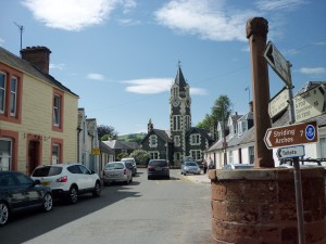
Moniave

Moniave

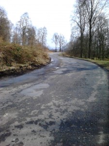
From here I did a quick loop up to Penpont then took the B729 from Moniave across to the A713 at Carsphairn. A beautiful, deserted road which oscilated between two lanes and single track. As I came round a bend a small loch was to my right and a family of geese was crossing the road directly ahead of me. I stopped to let them pass and scrambled to get my camera out to take a photo of them, but I wasn’t quick enough and this is the best I could manage (click on the photo to enlarge).
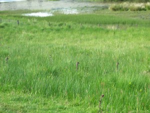
Geese on the B729

Geese on the B729

The A713 took me all the way back to Ayr where I picked up the A77 back to Glasgow.

The position so far:

             Miles                Km                   £
Overall Target 3,107 5,000 £5,000.00
Total this Trip 278 447.4  
Total to Date 1,592 2,562.1 164.85
Left to Go 1,515 2,437.9 £4,835.15

If you’re enjoying reading this blog, then please help me reach me raise £5,000 for charity by donating using the JustGiving link below. You can find out more about my “5K for £5K Challenge” here. Thank you.

JustGiving - Sponsor me now!

Trip 5: Skye

Saturday 8 June and Sunday 9 June 2013


View Trip 5 – Skye in a larger map

The forecast was for fabulous weather this weekend so being a rare event in Scotland I decided to do an overnight trip to Skye. Not wanting to abandon my cat without food or water, I went to the pet shop and got him a food dispenser. A trial run proved it worked, so I filled it up with food and set off.

I collected my bike from my friend’s house then came back to mine and loaded it up with camping gear. As I was doing this, I realised I’d left my camera in my bag at my friend’s. Darn! I couldn’t go to the jewel in Scotland’s tourist crown without being able to take photos so twenty minutes was lost returning to her’s to get it.

Camera retrieved I went up the A82 again (just as well it’s such a gorgeous road as this was the third time I’d been up it in two months). Through Glencoe again and on to Fort William where I joined the Road to the Isles. This is one of my favourite roads – a long straight stretch runs parallel with the railway along the side of Loch Linnhe, then it heads over a hill to Glenfinnan, past the monument and the railway viaduct (featured in the Harry Potter films). I’d forgotten it was there so had a quick stop to refresh my memory.

Glenfinnan Monument

Glenfinnan Monument

From there the road continues west a bit further then heads north to Mallaig, affording fabulous views of white, sandy beaches and the isles of Rum, Eigg and Muck beyond.

Morar beach with Small Isles in the background

Morar beach with Small Isles in the background

I had a three hour wait in Mallaig as I hadn’t booked the ferry and the next two were full. It was glorious sunshine though so I wandered about, soaking up the rays and taking in the views.

Packed ferry to Skye

Packed ferry to Skye

I made it to Skye by 5.30 pm and took the southern road to Dunvegan on the west side, passing by the foot of the Cullins. These are spectacular jagged peaks that rise far above everything else and can be seen from all angles of the island.

The Cullins

The Cullins

Arriving in Dunvegan I made my way to the Kinloch Campsite, a beautiful spot right on the coast. I pitched my then, then made something to eat. There is something supremely satisfying about making a meal using a camping stove. Maybe it brings out those “hunter gatherer” instincts, but I swear, my simple meal of pasta, pasta sauce and bacon, was the best thing I’ve ever tasted. So was the cup of tea that followed it.

Camping at Kinloch Campsite

Camping at Kinloch Campsite

Next morning I was up at 6 am. I couldn’t sleep anymore. In fact, I’m not sure I ever really slept. I just seemed to creak from one solidified position to the next. Camping is a great idea in theory, but the reality is that I’m getting far too old and stiff for it.

What a view to wake up to!

What a view to wake up to!

The midges were out in droves so I quickly rustled up some breakfast in the wash-house to try and get away from them, then packed up and was on the road again by 8 am. I headed south west along a single track road to Galtrigill where the road runs out. A group of cows protecting a calf prevented me making it all the way to the end, so I turned around and took another single track over to Glendale, a typical island village.

Cows warding me off

Cows warding me off

Glendale Post Office

Glendale Post Office

Next, I wanted to get the ferry from Kylerhea to Glenelg, back on the mainland. This time I took the northern road from Dunvegan, past Portree to Broadfoot where, a few miles later, I picked up the road to the ferry. Now I’ve done some small, twisty single track roads in my time, but this one was exceptional. As you get to the top of the pass you get the most spectacular view down to the narrows below. The road then descends down a near vertical track to the slipway at the bottom.

View from top of pass to Kylerhea narrows below

View from top of pass to Kylerhea narrows below

The Kylerhea – Glenelg ferry is the oldest crossing in Scotland and is serviced by the last ferry of its type – one with a rotating deck. The water in the narrows moves very quickly and the ferry has to cross it at an angle so that by the time it arrives it has been swept back to the right level to dock.

Kylerhea - Glenelg ferry

Kylerhea – Glenelg ferry

Me, on board the ferry

Me, on board the ferry

Having been safely delivered to the other side, I followed the road from Glenelg all the way to its end. Another winding single track up through pine forests and along rugged shorelines. A fine journey, but possibly a step too far as I was starting to get very tired now. The road was a dead-end so I had to retrace my steps back to Glenelg before I could pick up another single track to Sheil Bridge where I rejoined the main road through Glen Garry to Invergarry. From here the A82 took me south through the Great Glen. This should have been a fairly quick piece of road but my progress was impeded by hundreds of cyclists (six-hundred to be exact). At a stopping place outside Spean Bridge I discovered they were all doing the John O’Groats to Lands Ends (or JOGLE as it’s commonly know) ride. I didn’t quite get to the bottom of why they were doing this, but as they all seemed to be stopping here, I got back on the bike and continued to Fort William.

From here it was back down the A82 through Glencoe, down to Tyndrum and back along Loch Lomond to Glasgow. I got home at 7 pm having covered 499 miles. Cozy had survived his time without me but I noticed he actually let me pick him up and sat happily on my lap while I stroked him – something he never normally does. It’s always difficult to tell what cats think of you but I think he was relieved to have me back – as was I.

For full photo gallery
Trip 5 – Skye

The position so far:

  Miles Km £
Overall Target 3,107 5,000 £5,000.00
Total this Trip 499 803.1  
Total to Date 1,314 2,114.7 149.85
Left to Go 1,793 2,885.3 £4,850.15

Remember, you can find out more about my “5K for £5K Challenge” here or make a donation by clicking the image below. Thank you.

JustGiving - Sponsor me now!

Trip 4: Ardnamurchan

Saturday 25 May 2013


View Trip 4: Ardnamurchan in a larger map

This trip’s destination was Ardnamurchan, the most westerly point on mainland Scotland. The sun was shining so I leapt out of bed and was on the road by 8.45 am. Straight up the side of Loch Lomond on the A82 until Tarbet where I took the right fork and continued on the A82 to Tyndrum. A quick stop in the Green Welly then onwards on the A82 to Glencoe. After Bridge of Orchy the road starts to climb. There’s a fabulous lookout half way up so I stopped there to take a photo and met a couple of guys on bikes who were on their way to Inverness.

Me at the Bridge of Orchy viewpoint

Me at the Bridge of Orchy viewpoint

From there, the road passes through Rannoch Moor before entering into Glencoe itself. I think the word “awesome” is so over-used these days it loses its meaning, but it is absolutely the right word to describe Glencoe. Huge, sweeping peaks rise up on either side. Depending on the weather, it can be either deathly eerie or jaw droppingly spectacular. The latter was the case today.

Glencoe

Glencoe

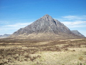
Buchaeil Etive Mor, Glencoe

Buachaille Etive Mor, Glencoe

Next stop was Inchree to get the ferry to Corran. It’s only a short crossing – you can see the slipway on the other side – in fact, the wait was longer than the crossing itself. Then I was off. Miles and miles of single track roads through groves of lime green trees rising up and down along the coastline. It’s one of my favourite routes.

Single track road on Ardnamurchan

Single track road on Ardnamurchan

At Salem I turned left onto the Ardnamurchan peninsula itself and followed it over undulating moorlands (where I saw two deer) round to Kilchoan.

My plan was to catch the ferry from there to Mull, then head down to Craignure where I was booked on the 7 pm ferry to Oban. It was 2.30 pm by now and the next ferry from Kilchoan was at 3.15 pm. If I was quick, I could make it up to the lighthouse and back in time to catch this connection. It was only 6 miles each way, but on twisty single track roads, it was going to be a challenge to make it in time. But I liked a challenge, so I fired up the bike and headed off.

There’s not many times I ride like a racer, but now was one of them. I was charging along, fleeing around corners, gunning it up hills and bombing along straights. I should have realised it wasn’t a good strategy for these type of roads, and soon I was to get my comeuppance. As I came hurtling round a bend, I lost my line, crossed onto the wrong side of the road and ploughed into a two foot long pothole in the verge. My left foot flew off its peg as the bike crashed into the hole and slammed down on the tarmac smashing my toes. Momentum carried the bike out the other side and back onto the road surface but it lurched left and right and I thought I was going to lose it. Then, as quickly as it all started, it stopped. The bike righted itself and I was able to carry on.

I should have paid heed to the warning though. I was tired and hungry and needed a rest, but I was almost there, so I would get a rest in a minute.

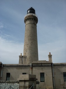
Ardnamurchan Lighthouse

Ardnamurchan Lighthouse

When I arrived at the lighthouse, the road passed two car parks then circled the lighthouse. The sensible thing to do would have been to park in one of the car parks, but not thinking very clearly, I rode past these and started riding round the lighthouse. It was a gravel track, something that would usually have put the fear of God into me, but this shows how tired I was becoming as I didn’t even notice it and started riding round the base. Next thing I knew the bike was on the ground. I’d hit the edge of a raised drain and the whole thing got thrown over. I don’t even remember if I fell off or got thrown from the bike. All I knew was the bike was on the ground and petrol was flowing out of the tank. I needed to get it back up before the heat from the engine ignited it. Amazingly, the engine had switched itself off, but it was not a good situation. I tried to remember all the videos I’d watched on picking up a fallen bike, but my mind went blank. I needed assistance, so I went off to the museum, found a couple looking at the exhibits and asked for their help. Together, the three of us, got it upright again but I’d broken the right front indicator and the mirror had been bashed off at an angle that no amount of pushing and pulling would release it from.

Scene of the crash - remains on my indicator in foreground

Scene of the crash – remains on my indicator in foreground

It was time to stop. I was trying to cram too much into my day. I parked the bike in the car park and had some lunch in the cafe. So, it had finally happened – I’d lost control, twice in a row. My foot felt like I might have badly bruised my toes but otherwise I was unscathed.

Needless to say, the ride back to the ferry was a much calmer affair. I was early so I amused myself by setting up my tripod and taking a picture of myself using the self-timer for the staff magazine at work.

Waiting for the ferry at Kilchoan

Waiting for the ferry at Kilchoan

I arrived in Mull at 5.30 pm. My next connection was 7 pm from the other end of the island. I had no idea how far it was, so learning nothing from my near miss, I hurried on down the single track road south from Tobermory. Everyone was going in the opposite direction and no-one was giving way to me and I was having to stop continually. All I could see in my right mirror was my own face (a somewhat disconcerting sight) which meant I was pulling out blind from every passing place. When I finally got to Salen, half way down, I saw a sign saying it was only 13 miles to Craignure. The road expanded into two lanes here so I was able to slow down, relax and take in some of the fabulous views around me.

I got the ferry terminal at 6 pm. Three cyclists arrived shortly after me and started chatting. Then an American man called Chuck pulled up next to me and told me he had a Bonneville America but wished he’d just bought the regular Bonny as he didn’t like the handling of the America. When I told him about my crash, he then heaved my mirror back into place which made the final run home to Glasgow much safer.

Arriving in Oban

Arriving in Oban

The ferry to Oban was late so it was 8.15 pm before we docked. Already the light was fading so I just had to blast it all the way home, eventually arriving at 10.40 pm. It had been a marathon of a day and made me question the wisdom of my idea to visit all destinations on this Challenge within a day.

For full photo gallery:
Trip 4 – Ardnamurchan

The position so far:

Miles Km £
Overall Target 3,107 5,000 £5,000.00
Total this Trip 272 437.7
Total to Date 815 1311.6 £124.85
Left to Go 2,292 3,688.4 £4,875.15

Remember, you can find out more about my “5K for £5K Challenge” here or make a donation by clicking the image below. Thank you.
JustGiving - Sponsor me now!

Trip 3: Central Belt

Saturday 11 May 2013


View Trip 3: Central Belt in a larger map

It was low cloud and drizzle when I got up and I almost decided to call off my trip and leave it to another day, but a challenge is a challenge and if you cry off every time it’s raining, then you’d never go anywhere in Scotland. So I donned my gear, started up the bike and headed for Falkirk.

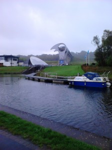
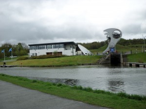
By the time I got onto the M80 north the rain was torrential. Low cloud reduced visibility to about 50 feet so the ride to the Falkirk Wheel was horrible and I was dripping wet by the time I got there. I parked the bike and set off to find the Wheel. As it came into view my gaze was drawn skywards to the huge structure looming above me. The next thing I knew I was flying through the air and landing on my arse in a flower bed. Someone had left a tangerine on the pavement and, like the proverbial banana peel, I’d slid on it and went flying. I was now soaking wet AND covered in mud. Not the best start to the day.


Falkirk Wheel

Falkirk Wheel

Falkirk Wheel

Falkirk Wheel

Falkirk lies in the Central Belt, an area that covers about a 50 mile stretch between Glasgow and Edinburgh. Given it’s so close, it’s an area I’d never really explored before. However, today I needed to find a landmark in connection with the Round Britain Rally that I was participating in, and as Yvonne Harley from MAD Scotland had contacted me via Twitter about my book, and invited me to look her up if I was passing, I’d asked her if she could show me the way.

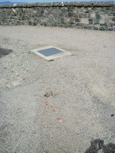
When Yvonne arrived, we had a quick chat then headed into Falkirk. Yvonne was an excellent rider who looked like she’d been riding bikes all her life (which, it turned out, she had). She led me through large industrial estates with more car showrooms than I’ve ever seen in my life, before we reached a residential area which led to the park where the landmark was located. Landmark found and photographed, we headed off to South Queensferry to visit the Bikers Cove cafe.

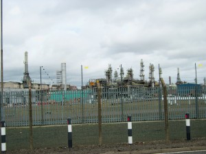
Falkirk is clearly in the middle of Scotland’s industrial heart-land. The town sprawls for several miles and seems to blend with the edges of Grangemouth, where a huge refinery is based. Massive cooling towers scrape up into the skyline for mile after mile. I followed Yvonne as she navigated us onto the A904 to Bo’ness, a much prettier, residential town, lined with stone villas overlooking the Firth of Forth in the distance. Another turn a few miles later and we joined a coast road which gave spectacular views of the Firth of Forth and the road and rail bridges ahead of us. A quick stop in a parking bay for some photos and we continued down into South Queensferry.

The Forth Bridges

The Forth Bridges

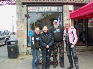
The Bikers Cover cafe is a tiny, little cafe with a big, friendly atmosphere, right at the foot of the railway bridge. I was introduced to Trish and Chas, the owners and plied with tea and a bacon roll. There was a fun crowd of people there so we spent the next hour or so chatting to anyone that came in.

Forth Rail Bridge from South Queensferry

Forth Rail Bridge from South Queensferry

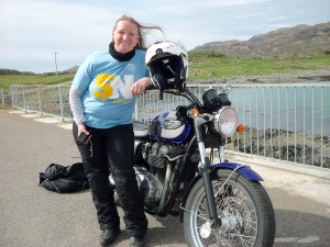
Tricia, Me, Chas and Yvonne at Bikers Cove

Tricia, Me, Chas and Yvonne at Bikers Cove

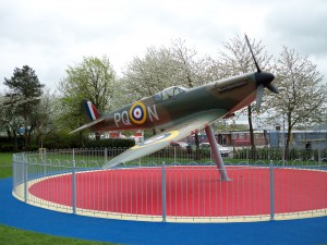
On the return trip, Yvonne detoured into Grangemouth so I could get a better view of the refinery. The road weaves right through the plant and I found it quite awe-inspiring passing through such massive structures. We stopped to see an old Spitfire that had been erected at the roadside, then we parted ways and I started to make my way home.

Grangemouth Refinery

Grangemouth Refinery

Spitfire at Grangemouth

Spitfire at Grangemouth

Beyond the refinery, Grangemouth becomes a vast industrial estate, flanked with factory units, warehouses and storage yards. I had no idea so many industrial plants were located here. So this is where Scotland’s manufacturing hub is located.

From Grangemouth I joined the M9 then the M80 back towards Glasgow. The wind was very blustery by now and I was getting buffeted across the carriageway so I took the back road from Cumbernauld down through Kirkintilloch to Glasgow.

Despite initial impressions, it had been a brilliant day and I was really grateful to Yvonne for her company and showing me around (click here to read Yvonne’s account of our day).

Yvonne Harley

Yvonne Harley

For full photo gallery:
Trip 3 – Central Belt

The position so far:

Miles Km £
Overall Target 3,107 5,000 £5,000.00
Total this Trip 103 165.8
Total to Date 543 873.9 £124.85
Left to Go 2,564 4,126.1 £4,875.15

Remember, you can find out more about my “5K for £5K Challenge” here or make a donation by clicking the image below. Thank you.
JustGiving - Sponsor me now!

Trip 2: Mull of Kintyre

Saturday 27 April 2013


View Trip 2: Mull of Kintyre in a larger map

Today’s destination was the Mull of Kintyre – Oh mists rolling in from the sea, my desire … but not today, oh no, sunshire, blue skies and light winds were the order of the day. And FREEZING wind-chill. My God, it was cold.

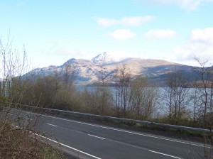
I headed up the A82 out of Glasgow, past Loch Lomond, and, for the first time ever, felt compelled to stop and take a picture of Ben Lomond, basking in the sun:

Ben Lomond from the A82

Ben Lomond from the A82

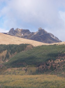
Up to Tarbet where the road splits, I took the A83 and followed it round to Arrochar. As I came over the brow of the hill as the road descends into the village, I got a crystal clear view of The Cobbler (aka Ben Arthur), so, again I stopped here for another photo:

The Cobbler from the A83 coming into Arrochar

The Cobbler from the A83 coming into Arrochar

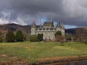
Onwards to Inveraray and more photo opportunites – isn’t it amazing how a bit of sunshine brings out the photographer in me:

Inveraray

Inveraray

Inveraray Castle

Inveraray Castle

From here, the A83 continues to Lochgilphead then Tarbert (that’s TarbeRt, not to be confused with TarbEt, mentioned earlier):

Tarbert

Tarbert

Leaving Tarbert, the road crosses to the west coast of the penninsula and it’s an exposed ride down to Campbeltown. On the way there, I noticed the ferry from Islay coming in to Kennacraig, so yet more photos here:

The Islay Ferry

The Islay Ferry

Approaching Campbeltown, I saw a sign for Machrihanish where an old wartime airfield was located so I detoured off the main road to have a look. It turns out, it’s now the Campbeltown Airport, a vast international hub with multiple terminals and a dedicated rail link (not!):

Campbeltown Airport

Campbeltown Airport

I left Glasgow at 8.45 am, and as it was now 1 pm and I hadn’t even made it to Campbeltown yet, I pressed on. As I left the airport, I joined a different road into the town. With only 2 miles to go, I then saw a sign post for Southend, from where I’d get to the Mull of Kintyre. The only reason I was going to Campbeltown was to take the road to Southend, so it seemed daft to continue to the town, when I could turn here. So a right turn it was and within a few miles, I found another sign to the Mull of Kintyre. Apart from Paul McCartney’s song, I have to confess, I had no idea what the Mull of Kintyre was so I didn’t really know if I was looking for a beach, a promontary or what? Then, just before I got to the point where the land looked like it was going to run out, I saw it, a sign saying “Mull of Kintyre Lighthouse – 8 miles”. Would you believe it – this was becoming like hill-walking – every time you think you’ve reached the summit, another peak comes along. But I’d come this far and I wasn’t going to cheat myself now, so I made another right turn and followed the road west.

Ever since I’d seen the sign for Southend I’d been on single-track roads, but this has to be one of the worst ones I’ve ever been on. It rose steeply up a hillside and narrowed into a tight-rope of a passageway. It was strewn with potholes and broken edges. Just when I was thinking, “I don’t think this road has ever been resurfaced in its life”, I came round a bend to find a resurfacing truck blocking the road with the driver asleep behind the wheel. A quick toot of my horn woke him from his slumbers and he pulled over enough for me to squeeze past.

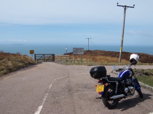
The road to the Mull of Kintyre Lighthouse

The road to the Mull of Kintyre Lighthouse

When I eventually made it to the end of the road, there was fence blocking access to an even smaller road which presumably took one round to the lighthouse on foot. But I was too cold and hungry by now to walk the indeterminate distance to the out of sight lighthouse, so turned around and headed back to Southend.

End of the road

End of the road

It was 2.30 pm before I found somewhere to have lunch. I only had soup and a sandwich, but when I remounted, there seemed to be considerable strain on my waistband and within a few miles of heading off, I had to stop and un-do the buttons on my riding trousers. They must have particularly fatty tuna in this part of the country.

I took a wrong turn out of Southend and ended up taking another beautiful, single-track road round to Campbeltown. But it took ages to cover the ground and when I eventually got to the town, it was 4 pm.

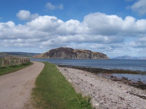
Island Davaar on the approach to Campbeltown

Island Davaar on the approach to Campbeltown

As if nearly losing my fingers to frostbite wasn’t enough for me, I decided to take another single-track road all the way back to Kennacraig from Campbeltown, instead of going straight up the A83. Although stunning, it took over an hour to cover the 30-odd miles. However, remarkably, I arrived back in Tarbert just in time to catch the 5.15 pm ferry to Portavadie on the Cowal Penninsula. This meant I wouldn’t have to go all the way back up to Inveraray, and would cut about 20 miles off my journey.

Docking in Portavadie

Docking in Portavadie

The road up the Cowal Penninsula has a fabulous viewpoint which overlooks Loch Riddon and the Kyles of Bute so a final photostop before making the last push home.

Loch Riddon and the Kyles of Bute from the Tighnabruaich viewpoint

Loch Riddon and the Kyles of Bute from the Tighnabruaich viewpoint

By the time I got back to Glasgow it was 8 pm. I’d spent almost twelve hours on the road with not much more than an hour off the bike for photo-stops and lunch. But what a day – it may have been freezing but God, Scotland is beautiful!

For full photo gallery:
Trip 2 – Mull of Kintyre

The position so far:

Miles Km £
Overall Target 3,107 5,000 £5,000.00
Total this Trip 295 474.8
Total to Date 440 708.1 £99.85
Left to Go 2,667 4,291.9 £4,900.15

Remember, you can find out more about my “5K for £5K Challenge” here or make a donation by clicking the image below. Thank you.
JustGiving - Sponsor me now!

Trip 1: Falls of Dochart

Saturday 13 April 2013


View Trip 1 – Falls of Dochart in a larger map

My 5K for £5K Challenge is underway and this is my first trip (woohoo!).

Last weekend the weathermen forecast a heatwave for this weekend. By Friday, the prediction had changed to strong winds and heavy rain. As I lay in bed yesterday morning thinking I really must get my 5K for £5K Challenge underway, it was low cloud and drizzly. However, a challenge is a challenge, so I dragged myself out of my cosy nest and headed over to my friend’s to pick up the bike.

What should have been a quick stop at the petrol station turned into a ridiculous fiasco. As I walked into the shop to pay for my fuel, I suddenly realised I’d left my wallet at home. The man behind the counter was very understanding but still made me fill in an “Inability to Pay” form. Jumping on the bike I rode home only to discover I’d left my house keys in my other jacket back at my friend’s house. So then I had to ride back to her’s, get the keys, ride back to mine, pick up my wallet, ride back to the petrol station again and pay. Fourteen miles and forty minutes later, I was ready to go.

As this was the first ride of the season and I was starting quite late in the day, I decided to make it a shortish trip to the Falls of Dochart. I followed the A81 from Milngavie up to Aberfoyle. A quick stop for a cup of tea and a cheeseburger in the car park there, and I headed over the Duke’s Pass towards Callander where I picked up the A84 up to Killin.

Duke's Pass

Duke’s Pass

The clouds had lifted by this stage and I was surrounded by stunning, snow-clad peaks but by Balquidder it was starting to get very cold. Fortunately, Killin was only a few miles further north so I was able to warm up when I stopped there to see the Falls of Dochart.

Falls of Dochart, Killin

Falls of Dochart, Killin

Coming back the temperature really dropped so I made a quick detour north to the Green Welly Stop at Tyndrum for a cup of tea before heading back along the A82 down the side of Loch Lomond.

View south from Tyndrum

View south from Tyndrum

Loch Lomond from Tarbet

Loch Lomond from Tarbet

Brilliant day!

For full photo gallery:
Trip 1 – Falls of Dochart

The position so far:

  Miles Km £
Overall Target 3,107 5,000 £5,000.00
Total this Trip 145 233.4  
Total to Date     £37.04
Left to Go 2,962 4,766.6 £4,962.96

Remember, you can find out more about my “5K for £5K Challenge” here or make a donation by clicking the image below. Thank you.

JustGiving - Sponsor me now!

Book Release – “Excess Baggage”

It’s finally out! My book, Excess Baggage: One woman, one motorbike and a huge amount of luggage ride across Australia, is out today.
What’s it about?

In 2010, after the closure of my dream business, I set off to tour Australia – alone on a motorbike. Weighed down by seven stone of luggage and a crushing sense of failure, my riding skills rapidly deteriorated. Freezing weather, violent winds and treacherous road surfaces all added to my fright.

I almost decided to give up and buy a car. But the need to overcome my fears pushed me on. Testing my resolve, Australia threw everything it had at me: the worst floods in living memory, extreme heat, plagues of insects, torrential downpours, hurricanes, isolation and my ultimate nightmare, gravel roads. But turning back was not an option.

What resulted was an exciting and heart-warming adventure through a vast, staggeringly beautiful but unforgiving landscape.

I really hope you enjoy reading it, and if you’d like to see the Photo Gallery of the trip, click here.

Where can I buy it?

To buy the book, please click the image above or you can go to any of Amazon’s international websites, including:

www.amazon.co.uk
www.amazon.com
www.amazon.fr
www.amazon.it
www.amazon.de
www.amazon.es

A Kindle version is coming soon too.

The 5K for £5K Challenge

As you will see from my 2013 – Scotland page, I am planning to ride round Scotland this year.  In doing so, I hope to raise £5,000 by riding 5,000 km, for the BMCRC Benevolent Fund which helps fallen riders and their families.

The only trouble is, I can’t do it all at once.  I’m going to have to do it over a series of short trips as I got adopted by a gorgeous little black and white cat in 2011, called Cozy, and I can’t leave him alone for too long.

Now, when you do the maths, it gives me a couple of options:

  • 5000 km ÷ 10 trips = 500 km per trip (310 miles)
  • 5000 km ÷ 20 trips = 250 km per trip (155 miles)

Then I’ve got to think about how many weekends there are between now and the end of “summer” season (and I use “summer” very loosely here – Scotland isn’t known for its scorching sunshine and soaring temperatures).  So realistically, I’m looking at April until the end of October.  That’s seven months.  So, by my calculations, this would give me:

  • 7 months x 4 weekends in each month = 28 weekends, or
  • 5000 km ÷ 28 weekends = 178.57 km per weekend

So let’s round things up a bit (to allow for not every weekend being possible):

  • 5000 km ÷ 20 weekends = 250 km per trip

Given Oban is only 100 miles from Glasgow and only takes a couple of hours to get to, this is more than do-able, in fact, 15 trips of 350 km would probably do it quite easily.

So now all I have to do is decide where to go. Here’s my Top 5 list of places I want to visit:

  • Cape Wrath and John O’Groats
  • Orkney and Shetland
  • Inner and Outer Hebrides
  • Wester Ross (and that road with all the hairpin bends)
  • Islay and Jura


View Scotland in a larger map
Instantly, I can see none of these trips fall into the 350 km in a weekend category, so it looks as if using the law of averages isn’t really going to help here.  I guess the main thing is that I know the ultimate goal and just knock off as many miles as I can each time.

I’ll be charting my progress on this blog, so please come back soon and see how I’m doing.  And remember, if you’d like to make a donation to my appeal, you can do so by clicking the image below:

JustGiving - Sponsor me now!